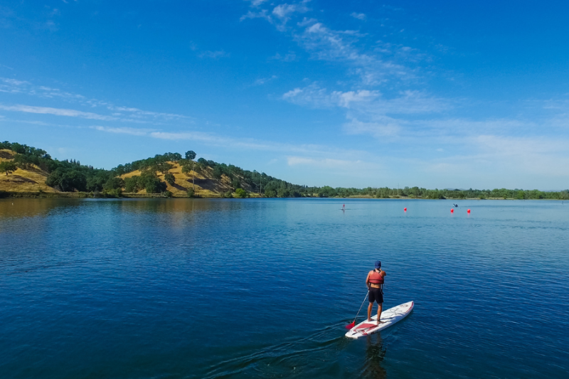

Sacramento has a 32-mile paved trail running along the American River from Discovery Park, just north of downtown, all the way east to Beal’s Point at Folsom Lake in Granite Bay. It goes by two names—the American River Parkway and the Jedediah Smith Memorial Trail—and it’s one of the longest continuous urban river trails in the country. Most locals know it exists. Far fewer know where to start, which access points have parking, or what the full route looks like. This guide covers the basics.
What It Is
The trail follows the south bank of the American River for most of its length, passing through riparian woodlands, open meadows, and several county parks along the way. The surface is paved for the majority of the route and is shared by cyclists, joggers, walkers, and inline skaters. Some sections pass through quieter, more wooded stretches; others run alongside residential neighborhoods.
The parkway itself is managed by Sacramento County Regional Parks. The trail within it is free to use on foot or bike. Some day-use parking areas along the route charge a vehicle fee; others don’t. Hours vary by site and season. For current parking fees and any trail closures, check regionalparks.saccounty.gov before you go.
Where to Start
The western trailhead is at Discovery Park, at the confluence of the American River and the Sacramento River near downtown. Discovery Park is at the end of Garden Highway and has a large parking area. This is the most accessible entry point from central Sacramento and a good place to start if you want to bike east toward the suburbs or walk along the river with an easy turnaround.
The eastern end of the trail is at Beal’s Point Recreation Area in Granite Bay, at the edge of Folsom Lake. If you’re driving out to start near Folsom and ride or walk back west, this is where you’d begin. Beal’s Point charges a day-use vehicle fee; check the current rate at the gate.
In between, there are more than a dozen public access points with parking. A few worth knowing:
- William B. Pond Recreation Area — off Arden Way east of Watt Avenue, Sacramento. One of the most popular midtrail access points, with picnic areas, restrooms, and parking. A vehicle day-use fee applies.
- Goethe Park — off Rod Beaudry Drive, Rancho Cordova. Quiet access point with parking and restrooms, good for entering the trail mid-route.
- Ancil Hoffman Park — off California Avenue, Carmichael. The park adjoins the trail and includes a golf course, picnic facilities, and the Effie Yeaw Nature Center for wildlife observation. The nature center has its own guide here.
What to Expect on the Trail
The trail is flat for most of its length, which makes it accessible to casual cyclists and walkers without much fitness experience needed. Sections near Discovery Park and William B. Pond see heavy use on weekday mornings and weekend afternoons; midweek and early-morning visits are quieter.
The riparian corridor along the American River is good for birdwatching year-round. Great blue herons, ospreys, and mergansers are commonly spotted in fall and winter. The trees along the lower sections turn color in November, which makes this one of the better leaf-change walks in the Sacramento area without leaving the city.
Trail sections are occasionally closed for maintenance or flood damage. The county posts current closures and detours at regionalparks.saccounty.gov. Check before a longer ride rather than finding a closure mid-route.
The Details
- Total length: 32 miles (Discovery Park, Sacramento to Beal’s Point, Granite Bay)
- Surface: Mostly paved; shared use by cyclists and pedestrians
- Trail use fee: Free to walk or bike; some parking areas charge a day-use vehicle fee
- Main western access: Discovery Park, end of Garden Highway, Sacramento
- Main eastern access: Beal’s Point Recreation Area, Granite Bay (vehicle fee applies)
- Trail status and closures: regionalparks.saccounty.gov
- Parkway Foundation: arpf.org
Bottom Line
The American River Parkway is one of Sacramento’s best outdoor assets and genuinely underused by people who live here. Fall and early winter are good times to go: the cottonwoods and willows along the river turn yellow in November, the heat is gone, and the trail is less crowded than summer. A 10- or 12-mile out-and-back from Discovery Park to William B. Pond is a reasonable half-day ride for most cyclists, and the same stretch works as a long walk if you have a few hours.
Hikers looking for more varied terrain can combine a trail walk with a stop at Lake Natoma, which connects to the eastern end of the parkway via the same trail system—see the Lake Natoma guide for what’s available there. For trails with more elevation gain near the city, the best winter hikes near Sacramento covers four options worth lacing up for.