
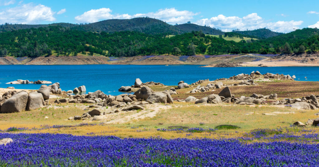
El Dorado Hills sits 25 miles east of downtown Sacramento in El Dorado County, organized around a series of residential villages built out from the early 1960s onward. The community is unincorporated—there is no city hall—and covers about 48.5 square miles at roughly 768 feet elevation, with Folsom Lake and the South Fork of the American River forming its northern edge.
The Housing Stock
El Dorado Hills was designed from the start as a master-planned community. The original layout from the early 1960s grouped homes into named villages—Ridgeview, Park, Crown, and Governors—that were built out primarily through the 1970s and 1980s. Later phases added Lake Forest Village in the 1990s. The larger master-planned communities of Serrano, Blackstone, and Promontory were developed from the late 1990s through the 2010s.
About 98% of closings in El Dorado Hills are single-family houses, according to Resideline’s October 2026 market data. Lot sizes vary significantly by neighborhood: the original villages typically run from under a quarter-acre to roughly half an acre, while hillside and estate parcels in areas like Highland Hills reach several acres. Newer master-planned communities like Serrano generally have lots in the 0.1- to 0.5-acre range, with many homes built between 2000 and 2015.
Home Prices
The median sold price in El Dorado Hills was $920,000 across 413 closed sales as of October 2026, according to Resideline. The middle half of closings ranged from $740,000 to $1,265,000, with a median price per square foot of $360. Homes have been going under contract in roughly 20 days at that price point. The mix runs almost entirely single-family—townhomes and condos make up a small share of the inventory.
Getting Around
US-50 is the main artery in and out of El Dorado Hills. Downtown Sacramento is about 25 miles west, and the drive typically runs 30 to 45 minutes during peak commute hours, with backups between El Dorado Hills and Rancho Cordova common on weekday mornings and evenings. There is no direct rail connection from El Dorado Hills to Sacramento; the nearest Sacramento Regional Transit light rail terminus is in Folsom, which requires driving to a park-and-ride. For more on navigating downtown Sacramento by transit, see How to Ride Sacramento Light Rail to Golden 1 Center & Downtown.
Parks and Open Space
The El Dorado Hills Community Services District (edhcsd.org) manages 28 parks across roughly 272 acres of park land, with another 281 acres of designated open space. Facilities include Promontory Community Park, the Steven Young Amphitheatre, and neighborhood parks distributed across each of the original villages.
Folsom Lake State Recreation Area runs along the community’s northern boundary. The lake has 77 miles of shoreline with multiple boat launches, kayak put-ins, and hiking trails throughout the area. The South Fork American River corridor also runs along the northern edge, with trail access and river landings at Skunk Hollow and Salmon Falls.
El Dorado Hills Town Center
The El Dorado Hills Town Center, located south of US-50 at the community’s center, is the main retail and dining district, with restaurants, a movie theater, and regular outdoor events. It’s the closest thing to a downtown in an otherwise unincorporated community.
Comparing to the Bay Area
The October 2026 median sold price of $920,000 sits below the medians for many Bay Area markets, with considerably more square footage and larger lots typical at that price point. The Sacramento-area economy is weighted toward state government, healthcare, and logistics. For roles requiring regular in-person time in Sacramento, US-50 is the only practical route from El Dorado Hills; remote and hybrid schedules have changed the calculus for some relocating from the Bay Area.
The Details
- Water and sewer: El Dorado Irrigation District (eid.org)
- Electricity: Pacific Gas & Electric (pge.com)
- Natural gas: PG&E delivers gas; additional supplier options are available through PG&E’s direct access program
- Trash and recycling: El Dorado Disposal (eldoradodisposal.com)
- High school district boundaries: El Dorado Union High School District (eduhsd.k12.ca.us)
- Elementary districts: Contact the El Dorado County Office of Education (edcoe.org) to confirm which elementary district serves a specific address in the 95762 ZIP code
- DMV: Search dmv.ca.gov by ZIP code 95762 for the nearest field office
- ZIP code: 95762
Bottom Line
El Dorado Hills is a master-planned community in El Dorado County built primarily between the 1960s and 2010s, with single-family homes accounting for nearly all of the housing stock. The median sold price was $920,000 as of October 2026 (Resideline). Folsom Lake runs along the northern boundary, the El Dorado Hills Community Services District manages 28 parks across 272 acres, and all east-west travel runs on US-50—there is no rail option from the community itself.
If you’re also looking at other Sacramento-area communities, see Moving to Folsom, CA and Moving to Roseville, CA.